How DJI Terra will help you to build your digital asset

As the world is moving toward advancements, we are looking for the latest technology in its simplest form. And to meet such demands, DJI brings the simple mapping software DJI Terra for drone pilots. Moreover, earlier it was never easy to build drone programs in any critical field. But, with the introduction of DJI Terra, the drone pilots got their answer for most of the streamlined solutions. However, there are many mapping software in the market claiming to be the best. But, choosing the right software that will provide effective data in less amount of time was still difficult to part. Thus, with this Terra software, the drone pilots got the most simple mapping software that requires no skill from the users. Furthermore, this mapping software now enables easy solutions to all the decisions concerning critical sectors, construction, agriculture, infrastructures, and more.
Moreover, the DJI Terra a mapping software enables to build of real-world scenes and sites in the digital asset. In addition, the mapping software is very simpler yet powerful to create 3D and 2D models of the real environment scenes. As the Software is easy to use, it is revolutionary for new drone pilots that can create the best results with less training.

What is DJI Terra and which devices supports this?
DJI Terra is easy and simple drone mapping software that converts drone data into digital assets i.e 3D and 2D maps enabling easy analysis and decision making. Moreover, this software has four licenses that include agriculture, cluster, Pro, and electricity. In addition, as per the license, the Terra software allows the organization of real-time mapping. And thus, gives 3D and 2D reconstruction and measurements in these categories. Furthermore, many DJI Aircraft are compatible with DJI Terra. It includes
- Phantom 4
- Phantom 4 Advanced
- Phantom 4 Pro V2.0
- Phantom 4 Pro+ V2.0
- Phantom 4 RTK
- Matrice 300 RTK+ H20 series
- Matrice 2 Enterprise Advanced
- Zenmuse P1
- Zenmuse L1
- Zenmuse X7
DJI Terra- Importance in drone photogrammetry
DJI Terra allows drone pilots to capture high-quality photographs and re-create the survey areas making it a digital asset. Moreover, Terra is the all-one solution for mapping, processing, modeling, and data analysis. In addition, it can digitalize any data from real-time scenarios with efficiency and accuracy. Furthermore, these 3D and 2D models are necessary for the reconstruction of buildings, inspection, tracking progress and spot mistakes, and more.
3D Modelling
DJI Terra can get a sharp and real digital representation of real-time scenes throughout various industrial applications. Moreover, the software creates realistic 3D models using a high-resolution 45MP full-frame DJI P1 camera. In addition, the software uses CUDA- a based reconstruction algorithm that processes large data in no time delivering quality products.
2D Modelling
Like 3D models, DJI Terra creates high-quality 2D orthomosaic. Thus, it enables drone pilots to get detailed and exact measurements of all critical projects. The same camera frame DJI P1 is used in 2D modeling.
LIDAR
DJI Terra is simple and compact software for LiDAR processing, especially for L1 LiDAR sensors. Moreover, the software combines IMU and GNSS data for processing point cloud data and visible light calculation. In addition, the software uses POS data calculation for creating reconstruction models with accuracy. The best part is software uses only 3 minutes to process data from 30 minutes mission. In comparison with other mapping software, DJI Terra is always superior. Furthermore, the software in post-processing supports color modes that include visible, altitude, reflectivity rate, and return numbers. The Terra software converts raw data into .las format which is standard point cloud format.
DJI Terra Features
Many surveys are proving that DJI Terra is 4 times better than other mapping software in terms of workflow. Moreover, it is the best mapping tool that is efficient, time effective, and supports all missions.
- Easy to use:-
DJI Terra is very easy to use as it doesn’t require any training to use the software. Moreover, users only have to drag and drop to import data from the DJI payload efficiently. In addition, users only have to extract the SD card from the drone, put it in a computer to import data, and just process it in 3D or 2D models. Furthermore, the software has 400% more data processing ability enabling large-scale reconstruction of real-time scenes.
2. Secure:-
DJI Terra does not require an internet connection that gives a secure environment for critical and sensitive data. Moreover, the online mode of this software allows verifying permission and access to paid features.
3. Mission planning and Data acquisition:-
DJI Terra allows inspection in detail and has unique mission planning. Moreover, the software has four types of unique mission planning that enable real-time 3D and 2D modeling.
- Area– The software allows drone pilots to select areas with just one tap and it generates an efficient flight path in that area.
- Waypoint- with this, drone pilots can customize the flight path in the area to simulate missions on 3D models.
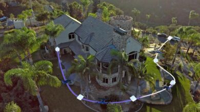
- Oblique- This lets drone pilots capture rich 3D models by tilting the camera angle giving an extra crisp view of the asset.
- Corridor- With this, the users may create flight missions by just drawing lines on maps around roads and railways. In addition, the software allows adjusting mission settings to choose between 3D models and 2D maps
Follow Dronephi on Twitter, Facebook, Instagram, and LinkedIn, or join on Telegram channel for all the latest updates on FPV, Drone Tech, Military Drones, Drone Related News, and more!


