DJI Terra 3.7.0 Update: Enhancing Efficiency and Precision in Aerial Data Analysis
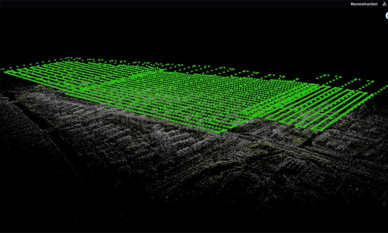
In the world of aerial data analysis and reconstruction, DJI Terra has established itself as a powerful tool for professionals in various industries. With its latest update to version 3.7.0, DJI Terra introduces several exciting features and improvements that further enhance the quality, speed, and accuracy of data processing. This blog post will provide an overview of the key updates in DJI Terra 3.7.0 and explain how they benefit users across different sectors.
Enhanced Data Quality:
One of the standout features in DJI Terra 3.7.0 is the introduction of the DJI Terra Quality Report. This feature provides users with detailed insights into the quality of their data, specifically focusing on aerotriangulation, 2D reconstruction, and 3D reconstruction. The Quality Report now supports the export of parameters such as Projections, GCP Reprojection Error RMS, and Forward Intersection Error in a convenient PDF format. This allows users to easily analyze and share the quality assessment of their data, enabling more informed decision-making.
Improved Reconstruction Capabilities:
DJI Terra 3.7.0 introduces the Auto Align Blocks function for 3D Reconstruction. This feature addresses the challenge of aligning block boundaries when splicing models. By automating the alignment process, users can seamlessly combine different blocks, resulting in a more coherent and accurate 3D model. This update significantly enhances the efficiency and precision of the reconstruction workflow, saving time and effort for professionals working with large-scale projects.
Streamlined Ground Control Point (GCP) Management:
GCPs are essential for achieving high-precision georeferencing in aerial data analysis. In DJI Terra 3.7.0, the Auto Identify Mark function has been added to the GCP Management module. This intelligent feature automatically identifies marks from other photos based on the first mark manually added by the user. It also displays a warning icon on photos with large reprojection errors, helping users identify potential issues and improve the accuracy of their GCPs. This streamlines the GCP management process, making it more efficient and error-free.
Flexible LiDAR Point Cloud Reconstruction:
DJI Terra 3.7.0 introduces new browsing and setting options for Ground Point Type in LiDAR Point Cloud Reconstruction missions. Users now have the ability to browse and define the Ground Point Type for LAS and PNTS output, providing greater flexibility in analyzing and processing LiDAR data. Additionally, the software includes a reducing model function that automatically reduces the resolution of high-resolution models by 50%. This feature facilitates online browsing, model editing, and other downstream operations while still maintaining the overall accuracy of the model.
Enhanced Reporting and Language Support:
With the latest update, DJI Terra now generates camera Position and Orientation System (POS) residuals, providing users with valuable information for analysis and troubleshooting. The software also extends its language support by including Korean and Italian, further broadening its accessibility and usability across a global user base.
Improvements in Stability and Performance:
DJI Terra 3.7.0 includes optimizations that enhance the stability and response speed of cluster reconstruction, worker device management, and reconstruction queue adjustment. These improvements ensure smoother operations and expedite data processing, especially in scenarios involving large-scale data reconstruction. Additionally, support for NVIDIA graphics cards of the GeForce RTX 40 series has been optimized, enabling better performance and compatibility with the latest hardware.
Bug Fixes and Recommendations:
The update addresses various issues, including occasional disconnection of worker devices, inconsistent device counts, and display anomalies. Furthermore, the DJI Terra team has fixed the issue where flight speed settings were limited for certain missions. These bug fixes improve the overall user experience and ensure a seamless workflow.
It’s important to note some additional details and recommendations for users of DJI Terra 3.7.0. Firstly, if you are upgrading from a version earlier than v3.4.0, it is necessary to update the driver of your NVIDIA graphics card to version 452.39 or later. This ensures proper functionality of the reconstruction feature.
Moreover, it’s worth mentioning that reconstruction results generated using the Seven-Parameter Transformation function and coordinate systems of newly supported countries on v3.5.0 or later versions may not be properly displayed on v3.4.4 or earlier versions of DJI Terra. Additionally, the Annotation and Measurement function will be unavailable. Therefore, it is recommended to use the latest version of the software for optimal performance and compatibility.
If you encounter any issues during the installation process, such as a corrupted file or no response, there is a simple solution. Right-click on the downloaded installation package, select Properties, and navigate to the General tab. If you see the message “This file came from another computer and might be blocked to help protect this computer” at the bottom of the window, select Unblock, and then click Apply > OK. This will ensure a smooth installation process.
Others
For users who have availed the free trial from the official DJI Terra website, it’s important to note that starting from v3.7.0 and later versions, the free trial is only available when using the latest version of the software and cannot be used offline. This ensures that users have access to the most up-to-date features and improvements.
When using DJI Terra v3.7.0 and later versions, it is recommended to use an NVIDIA graphics card with a GPU compute capability of 5.0 or above. This ensures optimal performance and compatibility with the software’s advanced features and capabilities.
If you choose to enable the reducing model feature, it’s important to consider that while DJI Terra preserves the model’s accuracy to the maximum extent, certain details may be lost due to the reduction in resolution. For missions that require a higher degree of detail restoration, such as nap-of-the-object photogrammetry missions, it is recommended to either disable the reducing model feature or set the parameter value higher than 80%. However, setting the parameter value lower than 20% may lead to incorrect texture mapping for flat areas, so caution should be exercised.
In LiDAR Point Cloud missions, enabling features such as Ground Point Type, Smooth Point Cloud, or Optimize Point Cloud Accuracy may result in longer reconstruction times. Additionally, the Smooth Point Cloud function is enabled by default in DJI Terra v3.7.0 and later versions. These settings provide users with more control and customization options but may impact processing time.
In conclusion, DJI Terra 3.7.0 brings several exciting features and improvements to enhance the efficiency and accuracy of aerial data analysis and reconstruction. The Quality Report, Auto Align Blocks, Auto Identify Mark, and other additions empower professionals in various industries to achieve higher-quality results and make more informed decisions. With optimized stability, performance, and bug fixes, DJI Terra continues to be a reliable and powerful tool for professionals in the field.
